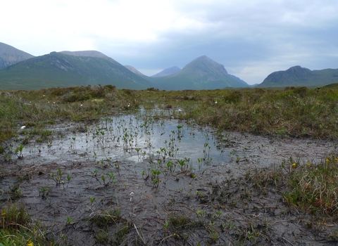
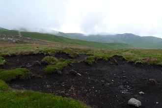
Peatlands are areas of land supported by an in-situ, naturally accumulated layer of peat. Peat soils are formed over long timescales from carbon rich, dead and decaying plant material under waterlogged conditions.
In a hydrological context, peatlands are commonly divided into just two basic types - those fed predominantly by surface water and/or groundwater (minerotrophic: fens), and those fed only by precipitation, having no contact with groundwater (ombrotrophic: bogs). However, there are many more peatland habitats found in the UK.
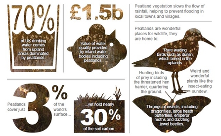
As iconic landscapes, peatlands offer breathing spaces for millions of people, support livelihoods and provide a sense of place for many communities. The peat itself harbours a rich cultural and historic archive with preserved artefacts from past human societies and a wealth of information about our changing environment, land management and climate. Peatlands are important source catchments for drinking water and also have a role in the regulation of water flows. They also support species and habitats that often depend on extreme, waterlogged conditions and are of international importance for biodiversity conservation.
UK peatlands
Covering around 10% of the UK land area, or nearly three million hectares, peatland habitat can be discovered in the most remote corners of the country, but also near the major centres of human population with livelihoods often intimately connected to their fate.
Appreciation of the wide ranging impacts and benefits of peatlands is relatively recent and as a consequence the majority have been historically managed in a way that has left them in a damaged state, with an estimated 80% of UK peatlands in some way degraded.
The majority of UK peatlands can be found in Scotland, where extensive carpets of blanket bog cover the landscape. A large extent of England's lowland peatlands are damaged due to historical and current land use change. Peatlands are found in each of the four countries.
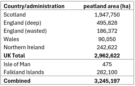
Extent of UK peatlands. Table modified from Artz, 2019. State of UK Peatlands.pdf
Mapping and monitoring of UK peatlands is essential to understand the extent and condition of these precious habitats. Explore the interactive maps to see the distribution of peatlands in England and Wales.
However, there are still knowledge gaps relating to monitoring the extent, distribution and condition of different peatland habitats in the UK, and the accurate mapping of peatlands is further complicated by questions around defining peat and peatlands.
The UK Peatland Strategy Progress Report (2024) outlines the latest state of knowledge on the condition of UK peatlands.
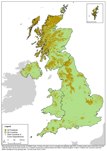
Estimated distribution of peatlands across the UK. Credit The Wildlife Trusts
Global peatlands
Peatlands cover 3% of the world’s land area – an estimated 4 million km2. They are found in 180 countries worldwide and span across all continents from naturally forested peatlands in Europe and tropical peat swamps in South East Asia, to vast permafrost areas of Russia and Canada, and high mountain peatlands in the Andes and Himalayas.
Peatlands are the world’s largest terrestrial carbon stock – storing at least 550 gigatonnes of carbon globally which is more than twice the carbon stored in all the world’s forests. However, latest estimates state that around 12% of global peatlands have been drained and degraded, contributing to 4% of annual global human-induced emissions.
See the latest Global Peatlands Assessment: The State of the World's Peatlands for more detail on global peatlands, and explore the UNEP Global Peatland Map below.
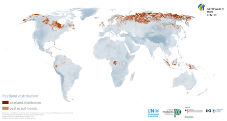
Global peatland map 2022. Credit | UNEP - UN Environment Programme

