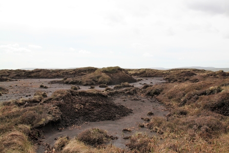
Bare peat on Fleet Moss. Credit: Lyndon Marquis Yorkshire Peat Partnership.

Bare peat on Fleet Moss. Credit: Lyndon Marquis Yorkshire Peat Partnership.
This week Natural England published the much anticipated England Peat Map. Using a combination of field measurements and cutting-edge modelling techniques, the Peat Map has, for the first time, mapped peat and peaty soils across England at all depth measurements above 0 cm. In addition to the mapping of depth, the Peat Map has also comprehensively mapped the vegetation cover types revealing that only 1% of England’s peatlands are dominated by Sphagnum mosses, while three quarters are covered by vegetation associated with drier conditions or bare peat. This underscores the extent of the restoration challenge which lies ahead, highlighted in our UK Peatland Strategy progress report last year. This was also reiterated by the Committee on Climate Change in the 7th Carbon Budget published in February 2025. The data paint a clear picture for the first time of the extent of England’s peatlands, the type of vegetation overlaying it and the drainage features associated with each site.
As Natural England state in their accompanying blog “what you can’t measure, you can’t manage”. The England Peat Map for the first time provides a vital tool for the peatland practitioner community to target restoration and management activities, for policy makers to make more informed regulatory decisions, and to inform scientific research.