The IUCN UK Peatland Programme advocates the multiple benefits of peatlands through partnerships, strong science, sound policy and effective practice.
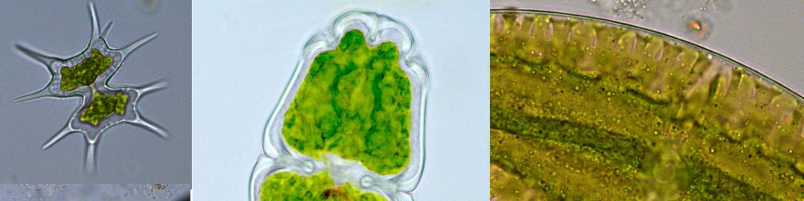
Desmids of peatlands © Emma Goodyer
Latest News
Latest News
Flow Country exhibition launched in Edinburgh
June 26, 2017
Royal Botanic Garden is the first venue for an important exhibition which will tour across the United Kingdom.
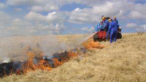
A New Management Approach for Grouse Moors
June 22, 2017
Recently, IUCN UK Peatland Programme met with staff from Moorland Association, Natural England and North Pennines AONB Partnership at Wemmergill Estate, near Barnard Castle, to discuss how to deliver healthy blanket bog on an active moorland grouse estate.
Crossing the Moss: The Story of a Solway Moss and the Solway Junction Railway
June 19, 2017
In the late 1860s, a railway – the Solway Junction Railway (SJR) – was constructed across the ‘Moss’ of Bowness Common. Where it met the Solway Firth, it soared above the waves to Annan on the Scottish side, across the Solway Viaduct – a structure that was “light and elegant, and in the full tide [had] the semblance of a piece of enchanted workmanship resting on the bosom of the racing waters”.
Going to The Royal Highland Show at Ingliston, Edinburgh this weekend (22-25th June) or the Scone Game Fair in Perth (30th June- 2nd July)?
June 19, 2017
Well, if you’re a landowner in Scotland with an area of peatland, such as a blanket bog or lowland raised bog, then funding is available to restore these extremely important habitats.
Droning-on over Abernethy
June 16, 2017
The RSPB’s Abernethy Reserve is perhaps better known for its Caledonian pinewoods, ospreys and capercaillie.
Innovative moorland campaign is Bogtastic!
June 15, 2017
The wheels are in motion to bring the breath-taking beauty of the Peak District and South Pennine moors to the people, allowing them to step onto a virtual peat bog without having to get their boots wet!
Peatland Restoration a key target in the new Cairngorms National Park Partnership Plan
June 14, 2017
The Cairngorms National Park Partnership Plan (CNPPP) is the overarching management plan for the Cairngorms National Park. It sets out how all those with a responsibility for the National Park will co-ordinate their work to tackle the most important issues over the next five years. Roseanna Cunningham, the Scottish Government’s Environment Secretary launched the new Plan on 1 June 2017.
Announcing Peat-Fest South-West 2025 – a celebration of our peatland connectionsThe Art and Energy Collective has been awarded a grant by The National Lottery Heritage Fund to…
National Policy Statements public consultationOpportunity to contribute to public consultation on National Policy Statements to support Clean…
Public consultation on heather and grass burning regulations in EnglandThe IUCN UK Peatland Programme has responded to Defra’s proposal to protect a greater extent of…
New Peat Map for EnglandThis week Natural England published the much anticipated England Peat Map which highlights the…
Peatland motion headed to World Conservation Congress for considerationThe IUCN UK Peatland Programme-led motion to develop a unified definition of peatlands has…
A collection of three Natural England reports marks a step change for English peatlandsWe summarise three new reports from Natural England which have important implications for English…
New publication: Tracks and roads on peatlandsThe IUCN UK Peatland Programme are pleased to publish our latest brief focusing on the impacts of…
Funding announced for greenhouse gas reduction solutions on peatlandsThe UK Centre for Ecology and Hydrology is seeking proposals for projects up to £75,000 to advance…
Committee on Climate Change (CCC) 7th Carbon Budget Report - a response from IUCN UK Peatland ProgrammeThe IUCN UK Peatland Programme welcomes this week the publication of the Committee on Climate…
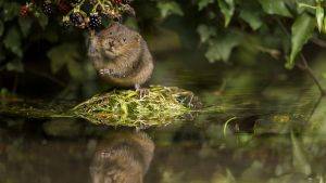
New species showcase - Water voleContinuing the spotlight on peatland biodiversity, our first Species Showcase of 2025 is the Water…
Adoption of University of Cumbria PhD student’s carbon calculator brings national and international significanceThis week University of Cumbria and Barker and Bland Ltd.’s innovative carbon calculator has been…
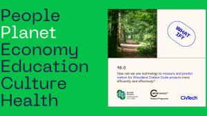
CiVTech innovators leading drive for advances within Peatland and Woodland Carbon CodesBringing efficiences to the Peatland Code and Woodland Carbon Code is the focus for three…